Use onX Backcountry to explore the terrain in 3D, view recent satellite imagery, and more.
Now available in onX Backcountry Mobile apps!
For more information see this post.
“This section connects the Northern Terminus of the Ozark Trail at Onondaga State Park to the OT Trace Creek section.
”
Features
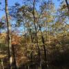
Commonly Backpacked · Fall Colors · River/Creek · Spring · Views · Wildflowers · Wildlife
The Ozark Trail through the Huzzah Conservation Area is foot-only: bicycles and horses are not allowed to help protect wildlife.
Description
At 48 miles, this section of the Ozark trail is perfect for a variety of trip options. Whether you’re hoping for a short outing near the Courtois Creek on foot, or a thrilling venture on a mountain bike while heading to the Berryman Loop and Hazel creek, this trail can provide a great experience. In addition to foot and bike travels, you can also explore this area via horseback to Huzzah Creek bluffs (a perfect place for a sunset!) or take multiple nights to explore this segment on a backpacking trip. This route is even perfect for those who might like to combine a hike with a quick float back down Courtois Creek!
Overlapping with the western section of the Berryman Loop Trail, this route continues to add on an additional 12.5 miles on its way towards an intersection with the Trace Creek Trail and the trail’s end at another trail intersection within the Huzzah Conservation Area. The route starts on its northern journey as a rocky singletrack along the creek, until eventually crossing Butts Road. From there, the route is more doubletrack, which remains consistent until the border of the Huzzah Conservation Area.
The new trail between Huzzah and Bass Resort that continues to Harmon Spring was completed in the spring of 2010.
The trail from Harmon Spring to Hazel creek is in good shape and is very popular with both mountain bikers and those with horses.
On at Onondago trailhead, off at Harmon Spring trailhead. I was out there for 2 nights. the trail down the hill to Courtois creek was very over grow
22mi
We use cookies to improve your browsing experience, to show you
personalized content, and for statistical purposes. By continuing
to navigate our website, you accept our use of cookies. Read our
Privacy Policy to learn more.

 Continue with onX Maps
 Continue with Facebook


 Particularly Special Place


 Intermediate/Difficult


0 Comments