
 Continue with onX Maps
 Continue with Facebook


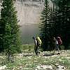
 Particularly Special Place


 Difficult
Difficult
Difficult
 Difficult
Land Manager: USFS - Boise National Forest Office
 Spanish Town Idaho
2.7 mi 4.3 km • 405' Up 123.58 m Up • 406' Down 123.83 m Down
 Idaho City, ID
 Norton-Big Lost Lakes Loop
4.9 mi 8.0 km • 1,596' Up 486.45 m Up • 1,596' Down 486.58 m Down
Sun Valley, ID
Alice-Toxaway Loop
19.1 mi 30.8 km • 2,985' Up 909.97 m Up • 2,985' Down 909.93 m Down
 Sun Valley, ID
Grand Sawtooth Loop
Sun Valley, ID
Grand Sawtooth Loop
71.7 mi 115.4 km • 13,387' Up 4080.31 m Up • 13,387' Down 4080.23 m Down
Idaho City, ID
 Washington Lake
14.7 mi 23.6 km • 3,055' Up 931.09 m Up • 3,054' Down 930.79 m Down


0 Comments