
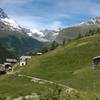
 Zermatt Lollipop
3.6 mi 5.8 km • 859' Up 261.88 m Up • 858' Down 261.64 m Down

 Zermatt - Trift - Zmutt Village Loop
13.7 mi 22.1 km • 4,666' Up 1422.07 m Up • 4,663' Down 1421.13 m Down
Zermatt, CH
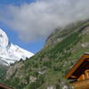
 Seven Lakes with Matterhorn Reflections
9.0 mi 14.5 km • 3,200' Up 975.27 m Up • 967' Down 294.87 m Down
Zermatt, CH
 Waldweg
5.1 mi 8.2 km • 17' Up 5.07 m Up • 2,114' Down 644.39 m Down
Five Seenweg
5.7 mi 9.2 km • 523' Up 159.53 m Up • 1,552' Down 472.98 m Down
 Zermatt, CH
Alpe Sattal
Zermatt, CH
Alpe Sattal
4.0 mi 6.4 km • 2,558' Up 779.79 m Up • 2,558' Down 779.73 m Down

 Continue with onX Maps
 Continue with Facebook


 Particularly Special Place


0 Comments