
 Continue with onX Maps
 Continue with Facebook


 Particularly Special Place


 Intermediate/Difficult
Intermediate/Difficult
Intermediate/Difficult
 Intermediate/Difficult
Land Manager: Maricopa County Parks
 Water Ranch Middle Route
1.3 mi 2.1 km • 20' Up 6.1 m Up • 20' Down 6.16 m Down
 Gilbert, AZ
 Usery Park Large Loop - South Side
7.6 mi 12.2 km • 243' Up 74.17 m Up • 244' Down 74.39 m Down
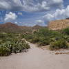
Hieroglyphic Trail #101
3.0 mi 4.8 km • 571' Up 174.16 m Up • 571' Down 173.96 m Down
 Apache…, AZ
 Second Water/Black Mesa/Dutchman Loop
9.3 mi 14.9 km • 994' Up 302.89 m Up • 994' Down 303.06 m Down
Apache…, AZ
Second Water > Boulder Canyon > Dutchman
11.7 mi 18.8 km • 987' Up 300.69 m Up • 993' Down 302.59 m Down
 Lizard/Cactus Over-the-Rock Loop
2.0 mi 3.3 km • 109' Up 33.35 m Up • 111' Down 33.86 m Down


 All Clear


0 Comments