
 Continue with onX Maps
 Continue with Facebook


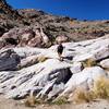
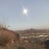
 Particularly Special Place


 Easy/Intermediate
Easy/Intermediate
Easy/Intermediate
 Easy/Intermediate
Land Manager: Maricopa County Parks
 Mesquite Trail Loop
3.8 mi 6.2 km • 182' Up 55.37 m Up • 182' Down 55.59 m Down


 Mesquite Canyon/Ford Canyon Trail Loop Clockwise
11.3 mi 18.2 km • 1,789' Up 545.38 m Up • 1,788' Down 545 m Down
 Mesquite Canyon Loop
8.7 mi 13.9 km • 1,543' Up 470.39 m Up • 1,542' Down 469.99 m Down
Citrus…, AZ
Skyline Circumference Loop
9.1 mi 14.6 km • 1,513' Up 461.06 m Up • 1,516' Down 462.01 m Down
Buckeye, AZ
North Top Summit
0.8 mi 1.4 km • 525' Up 160.05 m Up • 0' Down 0 m Down
Phoenix Sonoran Desert Preserve
5.6 mi 9.0 km • 697' Up 212.42 m Up • 697' Down 212.42 m Down
Cave Creek, AZ


 All Clear


0 Comments