Hiking Project Logo

A casual trail in the woods meets your average White Mountains lactic acid producing ascent!


Your Rating: Rating Rating Rating Rating Rating      Clear Rating
Your Difficulty:
Your Favorites: Add To-Do · Your List
Zoom in to see details
Map Key

5.3

Miles

8.5

KM

Point to Point

4,674' 1,424 m

High

1,429' 436 m

Low

3,337' 1,017 m

Up

93' 28 m

Down

12%

Avg Grade (7°)

44%

Max Grade (24°)

Dogs Off-leash

Features Fall Colors · River/Creek · Views · Wildflowers · Wildlife

Family Friendly Easy to follow trail. Nice river views. Difficulty begins mild with the ascent being moderate to strenuous. Peak lookout is very rewarding.

Description

The first 2.5 miles or so meander along a mild rolling trail following the south side of Whiteface Brook. There is one river crossing that, depending on river height, requires some well-balanced rock hopping to stay dry. At about 1.7 miles, the trail intersects at the Carrigan Notch Trail junction which goes north (right) towards Carrigain Notch. This junction can also link you to the Nancy Pond Trail and Stillwater junction. At approximately mile 3, the majority of the elevation gain begins, and the trail goes from mostly dirt and roots to small and medium sized rocks. Be prepared for the somewhat dramatic change in trail difficulty at this point. There are multiple small trail rivers, some which can run directly down the trail making for slippery rocks.

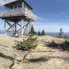
The trail consists of multiple switchback sections and is mostly tree covered, but there are a few small sections that provide window views of the surrounding mountain peaks. The final ascent occurs after ~200 ft of the Signal Ridge ridge line at ~4,400 ft elevation with great views. This is the first real picture-worthy viewing area. The peak can be seen to the northwest from the ridge line marked by a man-made look-out tower, which emerges up well over the tree line for 360-degree views.

The remaining ascent is a final push of ~200ft in elevation and ~ 0.5 mile distance. Views are best appreciated at the top of the lookout tower. The Presidential Range is viewable to the northeast. The Pemigewasset Wilderness and other 4,000 foot peaks such as Mount Layfayette, Lincoln and the Bonds to the northwest, and the Handcocks to the southwest.

The trail is dog and family friendly as there are no ladders or steep ledges to be concerned with; however, the lookout tower stairs may not be safe for doggy ascent and descent. Parents, use your best judgement with your kids; the lookout tower has large gaps between the handle rungs and stairs. Budget approximately 6 hours round-trip if you're moving at a steady, moderate pace.

Contacts

Shared By:

Christianne Maloney

Trail Ratings

  4.5 from 6 votes

#7889

Overall
  4.5 from 6 votes
5 Star
67%
4 Star
17%
3 Star
17%
2 Star
0%
1 Star
0%
Trail Rankings

#172

in New Hampshire

#7,889

Overall
7 Views Last Month
1,474 Since May 24, 2016
Intermediate/Difficult Intermediate/Difficult

0%
0%
29%
0%
71%
0%

Photos

Lots of rocks and roots.
Oct 3, 2020 near Livermore, NH
From the ridge approaching the peak.
Oct 3, 2020 near Livermore, NH
From the ridge looking to the peak in the clouds.
Oct 3, 2020 near Livermore, NH
View from the tower on the peak. Cloudy day.
Oct 3, 2020 near Livermore, NH

0 Comments

Weather


Current Trail Conditions

Unknown
Add Your Check-In

Check-Ins

Oct 7, 2021
Lora Doerfer
Oct 3, 2020
Adam Shutes
10mi — 5h 30m
Nov 9, 2019
Tavo Loaiza
Oct 7, 2018
Aleksandar Petakov
Sep 29, 2018
Greg Hinman
10mi
Aug 4, 2018
Cory Hard
Done on rainy day. Top barely above clouds sometimes. Slippery 14.6mi — 6h 00m
Jul 1, 2017
Christianne Maloney
11 miles round trip
Sep 4, 2016
Jon Little
13h 00m
Welcome

Join the Community

Create your FREE account today!
Already have an account? Login to close this notice.

Get Started