
 Continue with onX Maps
 Continue with Facebook


 Particularly Special Place


 Easy/Intermediate
Easy/Intermediate
Easy/Intermediate
 Easy/Intermediate
Land Manager: NPS - Great Smoky Mountains National Park
 Spence Field Loop
13.7 mi 22.0 km • 3,125' Up 952.51 m Up • 3,125' Down 952.37 m Down

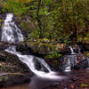
 Spruce Flats Falls Trail
1.8 mi 2.9 km • 452' Up 137.73 m Up • 452' Down 137.7 m Down
 Gatlinburg, TN
 Metcalf Bottoms Trail
1.3 mi 2.1 km • 112' Up 34.02 m Up • 111' Down 33.75 m Down
Fontana Dam - Shuckstack Fire Tower
9.2 mi 14.7 km • 2,371' Up 722.77 m Up • 2,371' Down 722.71 m Down
Robbins…, NC
Laurel Falls
2.5 mi 4.1 km • 351' Up 107 m Up • 351' Down 106.93 m Down
Gatlinburg, TN
Great Smoky Mountains Peak Loop
26.6 mi 42.8 km • 6,507' Up 1983.19 m Up • 6,921' Down 2109.61 m Down


1 Comment