
 Continue with onX Maps
 Continue with Facebook


 Particularly Special Place


 Intermediate/Difficult
Intermediate/Difficult
Intermediate/Difficult
 Intermediate/Difficult
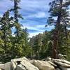
 La Quinta Cove to Pinyon Pines
14.7 mi 23.6 km • 5,350' Up 1630.68 m Up • 1,619' Down 493.47 m Down

 La Quinta, CA
Spitler Peak Out and Back
La Quinta, CA
Spitler Peak Out and Back
10.7 mi 17.3 km • 2,577' Up 785.44 m Up • 2,577' Down 785.38 m Down
Idyllwild, CA
 Tahquitz Canyon
1.8 mi 2.9 km • 316' Up 96.44 m Up • 316' Down 96.32 m Down
Lost Horse Mine Loop
6.4 mi 10.4 km • 664' Up 202.44 m Up • 679' Down 206.96 m Down
Round Valley Loop
4.3 mi 6.9 km • 788' Up 240.03 m Up • 792' Down 241.28 m Down
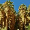
Palm Sp…, CA
Palm Canyon Loop
3.0 mi 4.8 km • 488' Up 148.87 m Up • 478' Down 145.62 m Down


0 Comments