
 Continue with onX Maps
 Continue with Facebook


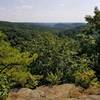
 Particularly Special Place


 Intermediate/Difficult
Intermediate/Difficult
Intermediate/Difficult
 Intermediate/Difficult
Land Manager: Ohio DNR - Tar Hollow State Park
 Logan Trail North Loop
9.8 mi 15.7 km • 1,476' Up 449.91 m Up • 1,490' Down 454.19 m Down

 Kingston, OH
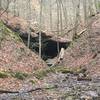
 Christmas Rocks State Nature Preserve
4.7 mi 7.5 km • 665' Up 202.76 m Up • 665' Down 202.78 m Down
 A.W. Marion State Park Loop
5.2 mi 8.3 km • 370' Up 112.72 m Up • 363' Down 110.76 m Down
Zaleski Backpack Trail South Loop
10.3 mi 16.6 km • 955' Up 291.04 m Up • 956' Down 291.42 m Down
Athens, OH
 Iron Furnace Out-and-Back
5.6 mi 9.0 km • 397' Up 121.02 m Up • 397' Down 121.15 m Down
McArthur, OH
Boch Hollow State Nature Preserve
9.2 mi 14.8 km • 1,462' Up 445.53 m Up • 1,458' Down 444.55 m Down
Geneva, OH


0 Comments