
 Continue with onX Maps
 Continue with Facebook


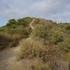
 Particularly Special Place


 Intermediate
Intermediate
Intermediate
 Intermediate
 Slab Loop
4.3 mi 6.9 km • 713' Up 217.29 m Up • 714' Down 217.64 m Down

 Penasquitos Creek Loop
13.1 mi 21.1 km • 319' Up 97.13 m Up • 319' Down 97.18 m Down
 Palacio Del Mar Views Loop
2.6 mi 4.2 km • 248' Up 75.53 m Up • 247' Down 75.25 m Down
San Elijo Lagoon: Annie's Canyon Loop
3.7 mi 6.0 km • 263' Up 80.11 m Up • 263' Down 80.16 m Down
 Solana…, CA
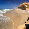
Torrey Pines State Reserve Loop
Solana…, CA
Torrey Pines State Reserve Loop
2.4 mi 3.9 km • 329' Up 100.18 m Up • 330' Down 100.46 m Down
Del Mar, CA
Aviara Oaks Loop
2.8 mi 4.6 km • 280' Up 85.27 m Up • 280' Down 85.33 m Down


0 Comments