
 Continue with onX Maps
 Continue with Facebook


 Particularly Special Place


 Difficult
Difficult
Difficult
 Difficult
Land Manager: NPS - Yosemite
 Mirror Lake Loop
4.7 mi 7.6 km • 290' Up 88.29 m Up • 289' Down 88.22 m Down

 Vernal and Nevada Falls Loop
6.2 mi 10.0 km • 1,999' Up 609.27 m Up • 1,998' Down 608.87 m Down
Yosemit…, CA
Happy Isles to Clouds Rest
18.3 mi 29.5 km • 5,782' Up 1762.48 m Up • 5,782' Down 1762.38 m Down
Yosemit…, CA
Yosemite Valley Traverse
13.1 mi 21.0 km • 3,990' Up 1216.16 m Up • 3,931' Down 1198.11 m Down
 Yosemit…, CA
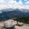
 Sentinel Dome
2.1 mi 3.4 km • 350' Up 106.59 m Up • 349' Down 106.51 m Down
Yosemit…, CA
Taft Point
2.3 mi 3.7 km • 276' Up 84.09 m Up • 276' Down 84.13 m Down
Yosemit…, CA


0 Comments