
Land Manager: City of Scottsdale
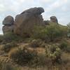
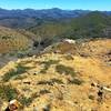
 Brown's Ranch
10.5 mi 16.9 km • 500' Up 152.51 m Up • 496' Down 151.19 m Down

 Sunrise to Andrews Kinsey Out-and-Back
9.1 mi 14.6 km • 1,476' Up 449.81 m Up • 1,475' Down 449.7 m Down
 Fountai…, AZ
Granite Mountain Loop
Fountai…, AZ
Granite Mountain Loop
6.3 mi 10.2 km • 447' Up 136.18 m Up • 446' Down 136.09 m Down
 Camelback Mountain via Cholla Trail
3.2 mi 5.2 km • 1,193' Up 363.49 m Up • 1,190' Down 362.66 m Down
Paradis…, AZ
North Top Summit
0.8 mi 1.4 km • 525' Up 160.05 m Up • 0' Down 0 m Down
Skunk Tank - Cave Creek Loop
10.5 mi 16.8 km • 1,661' Up 506.17 m Up • 1,661' Down 506.16 m Down
Carefree, AZ

 Continue with onX Maps
 Continue with Facebook


 Particularly Special Place


0 Comments